Thursday, April 25, 2024
HomeOceanCheck Out This 1940s-Era World Map Centered On The Oceans

Check Out This 1940s-Era World Map Centered On The Oceans

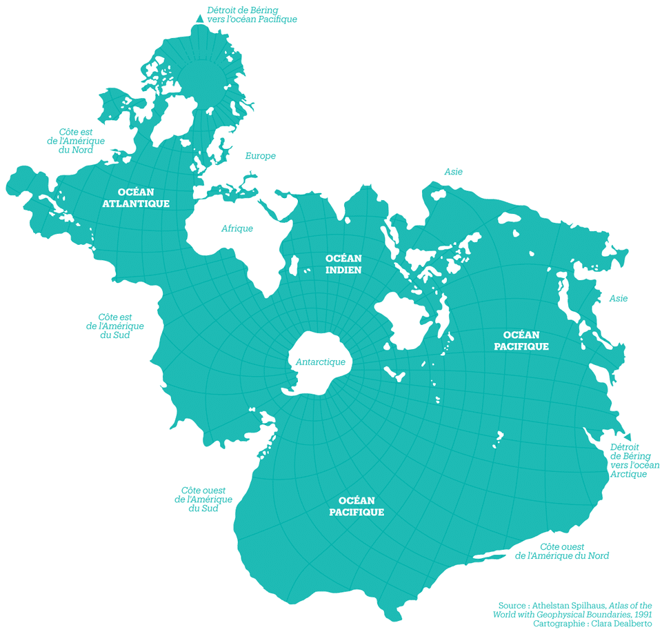
A world map produced in 1942 could serve as a reminder of the importance of the health of the Earth’s oceans.

Athelstan Spilhaus, an oceanographer who developed the bathythermograph during World War II (which detects differences in water temperatures below the surface), during the same conflict drew a map of the earth that puts more emphasis on the planet as a watery one than a land-based one.

With all the stresses placed on the oceans nowadays, it’s a good reminder of what really helps keep humanity alive.

In addition to the bathythermograph, Spilhaus was also an inventor who developed the “Skyways” in Minneapolis, Minnesota that helped keep pedestrians out of the freezing winter cold, along with other ideas.

Check out the map below, as well as all the other stuff he did here.

Athelstan Spilhaus's World Ocean Map
Athelstan Spilhaus’s World Ocean Map (Photo credit: BigThink.com)
John Liang
John Lianghttps://www.deeperblue.com/
John Liang is the News Editor at DeeperBlue.com. He first got the diving bug while in High School in Cairo, Egypt, where he earned his PADI Open Water Diver certification in the Red Sea off the Sinai Peninsula. Since then, John has dived in a volcanic lake in Guatemala, among white-tipped sharks off the Pacific Coast of Costa Rica, and other places including a pool in Las Vegas helping to break the world record for the largest underwater press conference.

1 COMMENT

LEAVE A REPLY

Please enter your comment!
Please enter your name here

This site uses Akismet to reduce spam. Learn how your comment data is processed.

SEARCH

CONNECT WITH US

858,282FansLike
110,581FollowersFollow
2,738FollowersFollow
22,801FollowersFollow
13,177FollowersFollow
25,921FollowersFollow
2,531SubscribersSubscribe

RECENT ARTICLES