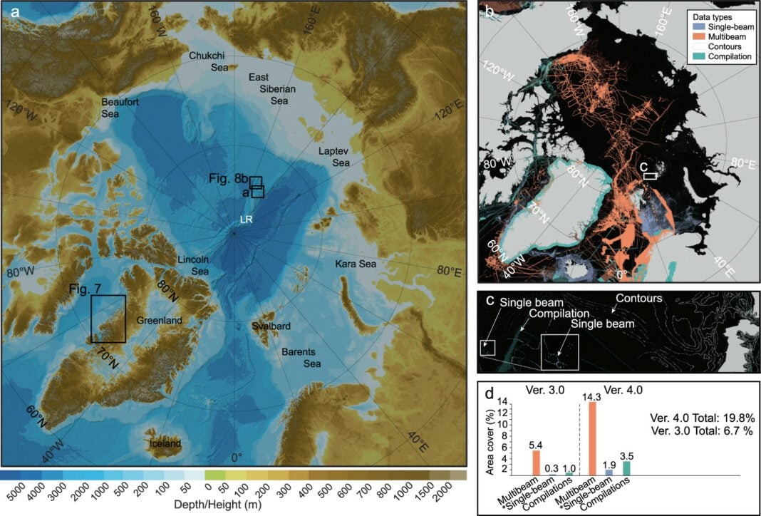
Scientists recently published new details on the depth of the Arctic Ocean, and the amount of seabed that is mapped has been increased from 6.7 percent in 2012 to 19.6 percent now.
The details were published in the journal Scientific Data. The new portrayal of the Arctic Ocean floor is in the form of a digital gridded database and comprises the fourth version of the International Bathymetric Chart of the Arctic Ocean (IBCAO).
The IBCAO has been the authoritative source of bathymetry for the Arctic Ocean since 1997, according to the journal.
Scientists and cartographers from 15 countries — including those that border the Arctic Ocean — took part in the work.
According to project co-leader Professor Martin Jakobsson of Stockholm University:
“IBCAO Ver. 4.0 represents the 2020 contribution to the GEBCO Global Grid which is targeted to map the entire ocean floor by the year 2030. Users need a specific grid of the Arctic Ocean in polar projection because the global grid is highly distorted near the geographic poles.”
Jacobsson and his colleagues write in the study:
“Thus, the new IBCAO Ver. 4.0 has substantially more seafloor morphological information that offers new insights into a range of submarine features and processes; for example, the improved portrayal of Greenland fjords better serves predictive modelling of the fate of the Greenland Ice Sheet.”
Check out the full article here.

