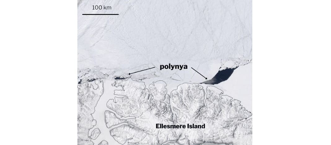
A new study documents the formation of a 3,000-square-kilometer/1,158-square-mile rift in the oldest and thickest Arctic ice.
The area of open water, called a polynya, is the first to be identified in an area north of Ellesmere Island, Canada’s northernmost island, and is another sign of the rapid changes taking place in the Arctic, according to researchers.
In May 2020, a hole a little smaller than the US state of Rhode Island opened up for two weeks in the “Last Ice Area,” a million-square-kilometer/386,102-square-mile patch of sea ice north of Greenland and Ellesmere Island that’s expected to be the last refuge of ice in a rapidly warming Arctic.
The polynya is the first one that has been identified in this part of the Last Ice Area, according to a new study detailing the findings in the American Geophysical Union journal “Geophysical Research Letters.”
The formation of the polynya was unusual because of its location, off the coast of Ellesmere Island, where the ice is up to five meters thick.
According to Kent Moore, an Arctic researcher at the University of Toronto-Mississauga who was lead author on the study:
“No one had seen a polynya in this area before. North of Ellesmere Island it’s hard to move the ice around or melt it just because it’s thick, and there’s quite a bit of it. So, we generally haven’t seen polynyas form in that region before.”
The surprise polynya formed during extreme wind conditions in a lingering anti-cyclone, or a high-pressure storm with high winds that rotate clockwise, Moore found. He combed through decades of sea-ice imagery and atmospheric data and found that polynyas formed there at least twice before, under similar conditions in 2004 and 1988, but no one had noticed.
(Featured image credit: NASA EOSDIS Worldview)

