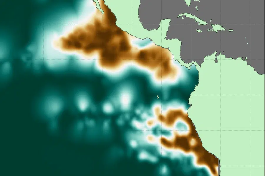
Scientists at the Massachusetts Institute of Technology have generated the most detailed, three-dimensional “atlas” of the largest oxygen-deficient zones in the Pacific Ocean.
The new atlas provides high-resolution maps of the two major, oxygen-starved bodies of water in the tropical Pacific. The maps reveal the volume, extent, and varying depths of each ODZ, along with fine-scale features, such as ribbons of oxygenated water that intrude into otherwise depleted areas.

The first zone off the South American coast measures about 600,000 cubic kilometers, pretty much the amount of water that would fill 240 billion Olympic-sized swimming pools. The second zone, off the Central American coast, is about three times bigger.
The atlas serves as a reference for where ODZs lie today. The team that made the atlas hopes scientists can add to it with more measurements, to better monitor changes in these areas and predict how they may move and change as the climate heats up.
According to MIT researcher Jarek Kwiecinski, who developed the atlas along with Professor Andrew Babbin:
“It’s broadly expected that the oceans will lose oxygen as the climate gets warmer. But the situation is more complicated in the tropics where there are large oxygen-deficient zones. It’s important to create a detailed map of these zones so we have a point of comparison for future change.”

