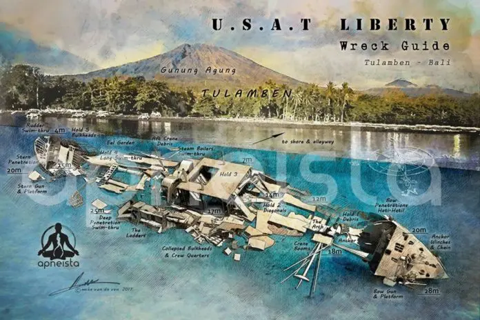
After thousands of hours of freediving, research and designing, Mike Van de Ven has released a set of comprehensive maps of the USAT Liberty wreck.
In collaboration with Apneista, Van de Ven, over a two-year period, researched, modeled and created a series of functional dive guides to the wreck, which was torpedoed and run aground during World War II. They are drawn from different angles with the emphasis on use by freedivers, but are also useful to scuba divers too.
This historic dive site sits at the foot of Mount Agung, which entered an active stage last year. Tremors from eruptions in 1963 shifted the ship from the beach to under the water. If the volcano erupts strongly this wonderful diver’s site could be destroyed forever.
For more info, check out the apneista.com website.

